
Walk a Mundelein Street by Address
A sound street-by-street search keeps ownership, registration, and occupancy distinct. The Lake County assessor search can turn an exact Mundelein address into a parcel identification number, or PIN, plus the taxpayer and legal description. The county map then gives the parcel context. Recorded deeds show transfers, while voter and historical sources may supply limited evidence about people connected to an address. No one result proves a full household.
- Enter the house number, direction, street name, suffix, and unit in the assessor search. Save the exact situs address and PIN.
- Open the same point in the Tax Parcel Viewer. Click nearby parcels rather than assuming one tax record represents the whole building.
- Read any voter record only through lawful inspection rules. Registration is limited evidence, not a list of all people at the address.
- Use the current taxpayer and legal description in the Lake County deed index. Match the parcel before accepting a name.
- For an older household, check a street guide or telephone directory for the relevant year and verify its locality.
This workflow makes the Mundelein street directory useful for property curiosity, family history, and checking a seller's link to a parcel. It also exposes conflicts early. A tax bill mailed to another city does not move the parcel, and a voter entry does not establish ownership.
Build the Mundelein Street Record
The assessor's basic screen is designed for a focused query. Enter a PIN without dashes, an owner as Last Name, First Name, a billing name, or the address fields. County instructions warn against mixing several main search modes. Wildcards can help, but a known address is the cleanest start for a street directory search.
| Portal field | Input | How it helps by street |
|---|---|---|
| Parcel ID | Text, no dashes | Returns one mapped tax parcel when known |
| Owner or Billing Name | Name text | Tests a name but may show a remote mailing recipient |
| Address No, Dir, Street | Text and direction list | Builds the exact physical-address query |
| Suffix, Suffix 2, Unit | Text or menus | Separates similar roads and multiunit parcels |
| City Name and ZIP | Menu and text | Narrows results without proving Village limits |
| Sort and page size | Menus | Orders results by parcel, owner, or address |
Record each label with its tax year. Useful output includes the PIN, situs and mailing addresses, land and building values, sale date and amount, property class, neighborhood, exemptions, and legal description. An exemption can support an owner-occupancy claim for that tax period, but it is not a live household roster.
The advanced property search provides a closer look at the available criteria.
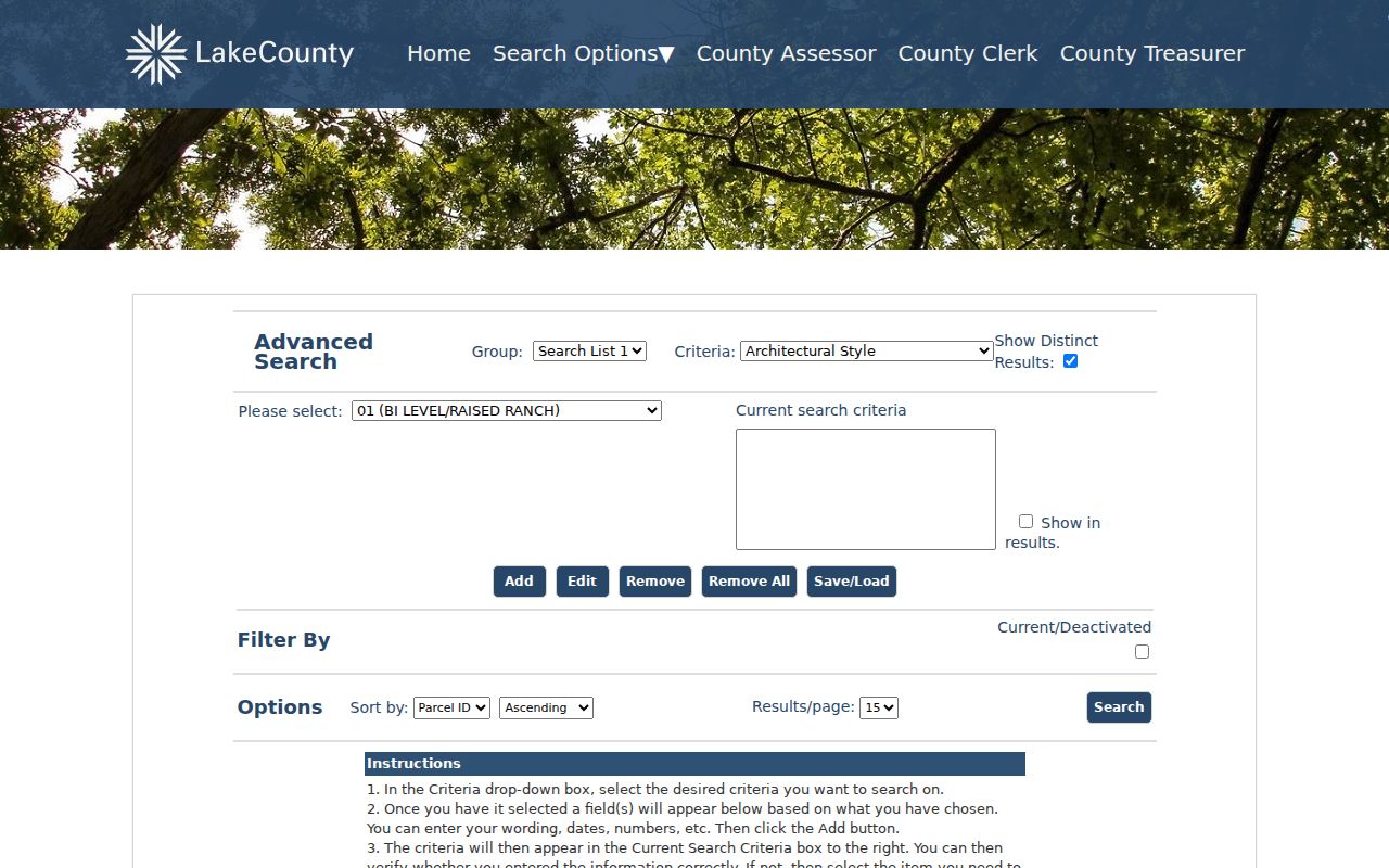
The captured screen shows the official county search surface that supports more precise parcel filtering than a broad web search.
Mundelein Streets Have Two Addresses
A key street-directory distinction is the difference between situs and mailing address. Situs means the place where the land or building sits. The taxpayer mailing address is where the county sends notices. It may point to another town, a business office, a trustee, a bank, or a care-of recipient. The research sample in the county parcel service paired a Mundelein situs and municipal label with a Chicago taxpayer mailing address.
That is not an error by itself. Copy both fields into separate columns, then use the PIN and legal description to connect the parcel to its deeds. Do not label the person at the mailing address as a Mundelein occupant. Likewise, a company or trust named as taxpayer says nothing conclusive about who sleeps at the property.
Insider tip. Use fewer words in a land-record query, try surname-first name order, and match legal descriptions when names produce too many results.
Map Mundelein Streets Parcel by Parcel
The Lake County Tax Parcel Viewer accepts an address through its county locator and can identify parcels from the map. Turn on road labels, address labels, lots, subdivisions, condominiums, tax parcels, and right-of-way layers as needed. A rectangle, line, circle, polygon, or point tool can form a visual shortlist. The configured buffer is not a promise of a working radius search, so click and verify each parcel.
Start at one known Mundelein house, zoom to the block, and record adjacent PINs. Parcel geometry helps reveal a condo, split lot, consolidation, or subdivision that an address-only search can hide. Yet the map carries a general-reference disclaimer. It is not a legal-boundary survey. Boundary questions require the recorded plat and, when needed, a licensed surveyor.
The underlying Lake County parcel map service shows the source behind many mapped fields.
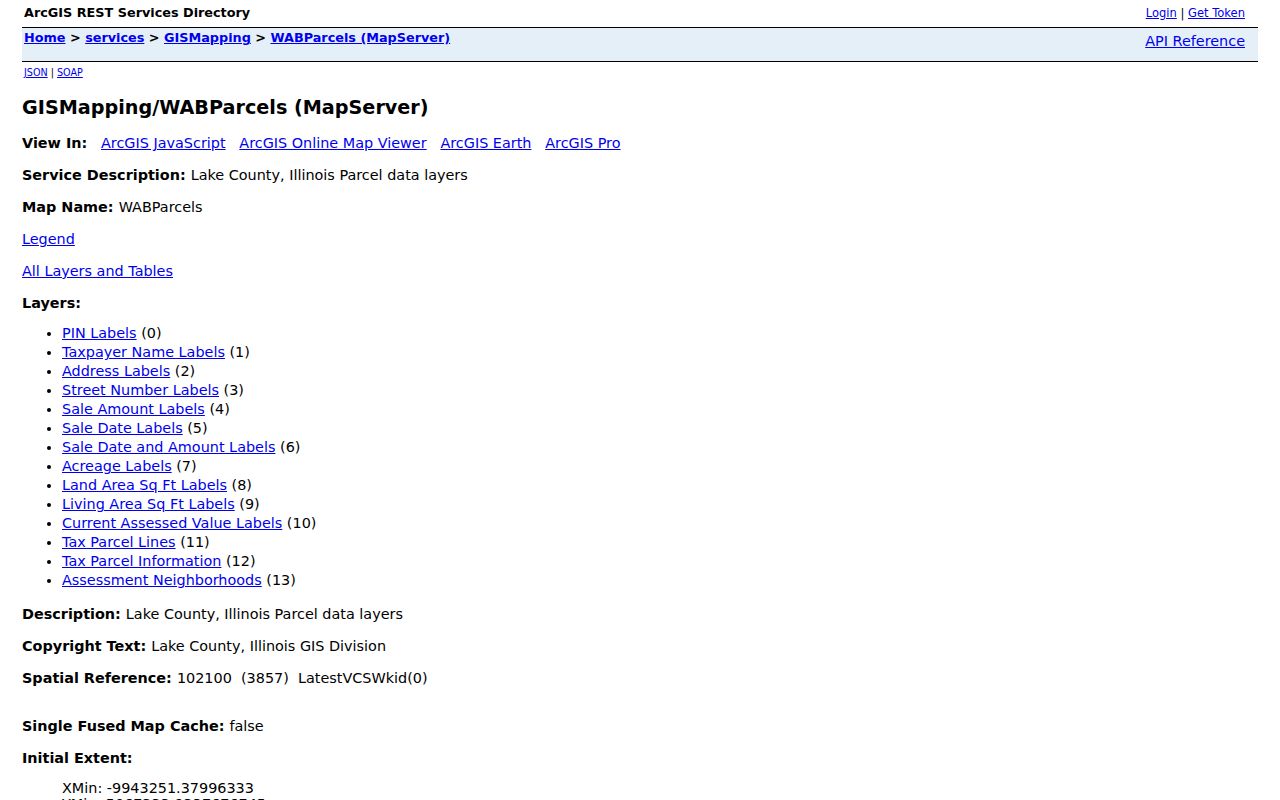
This service view reinforces that parcel, district, sale, and address fields are structured records, not proof of every resident at a home.
Mundelein Street Directory Sources
Each address-keyed source contributes a different part of a Mundelein street record. The table shows the source's strongest use and its access limit. Start with the address, but carry the PIN and legal description forward when a street name changes or an old index lacks an address field.
| Record Set | Keeper | What It Shows | Access |
|---|---|---|---|
| Parcel and tax card | Lake County CCAO | PIN, taxpayer, situs, values, sales, and legal description | Public basic or advanced search |
| GIS parcel map | Lake County GIS | Geometry, lots, roads, subdivisions, districts, and linked fields | Public viewer, general reference |
| Deeds and liens | Lake County Clerk Recording Division | Parties, instrument, date, number, and legal description | Regular online index from 1980; office books earlier |
| Permits and code cases | Mundelein Building Department | Applicant, project, certificate, or hearing dates | BS&A search or FOIA fallback |
| Voter registration | Lake County Clerk | Allowed registration and precinct fields | Lawful inspection; electronic limits apply |
| Historic street guides | Cook Memorial and Fremont libraries | Address-to-name evidence for a publication year | Verified regional images for 1949 and 1951 |
The PIN binds current tax and map sources. The legal description carries the search into older deeds and plats. A street name and number connect to permits, voter evidence, and street guides only after spelling, direction, unit, year, and jurisdiction are checked.
Follow Mundelein Streets Into Deeds
The Lake County public land-record search indexes the modern chain through grantor and grantee names, document types, dates, and other fields. A grantor gives or sells an interest; a grantee receives it. Begin with the current taxpayer as grantee and locate the purchase deed. Confirm its legal description. Then search the seller as a grantee in an earlier period to find that person's acquisition.
Regular online coverage begins in 1980, while recorded documents reach back to 1844. Earlier work moves to handwritten grantor/grantee books, the online index-book route, a file number, and Recording Division terminals or staff assistance. Staff can help locate an instrument, but they do not perform a title search. Older deeds may omit the current PIN and may identify land only by lot, block, subdivision, or section description.
- Parcel
- A mapped unit of land assigned a PIN for county records.
- Situs address
- The physical location of the parcel, not the tax mailing destination.
- Plat
- A recorded map that lays out lots, blocks, roads, and subdivisions.
- Criss-cross directory
- A historical directory arranged by street or phone, letting an address lead to a listed name.
Note: Search old records by name and legal description when a modern street address produces no match.
Mundelein Address Permits and Hearings
The Village's BS&A system makes permits and code or enforcement matters searchable by address. A result may identify an applicant, contractor, project, inspection, certificate, or hearing date. Those facts date activity at the parcel. They do not establish a sale or prove that the named applicant lived there.
When the dynamic system has no older record, use the Mundelein Building Department and its public-records request route. Complete year coverage and a fixed set of result fields were not posted in the research, so avoid assuming that an empty screen means no permit ever existed.
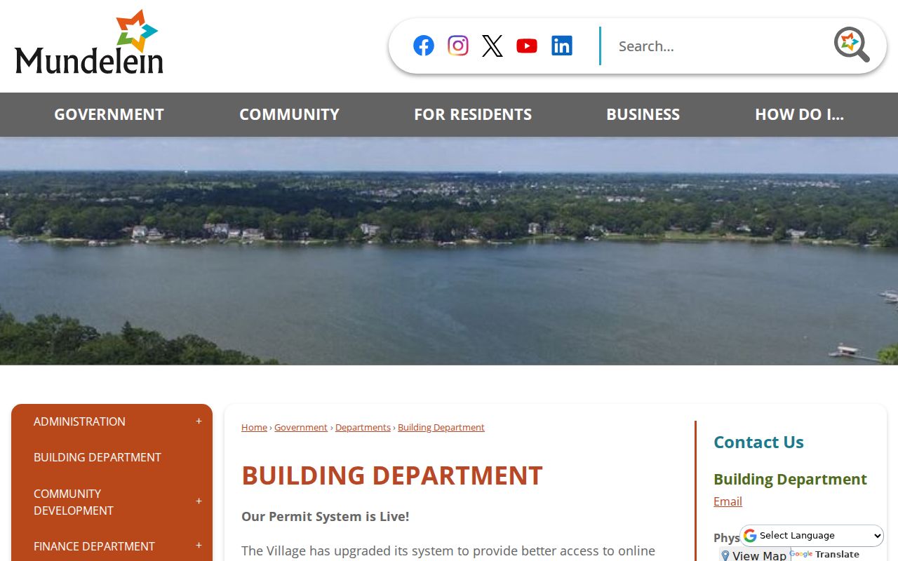
The official department page supplies the fallback when the address search does not expose the record or date needed.
Mundelein Street Names Across Eras
Mundelein records can carry older place labels. The community was known as Mechanics Grove, Holcomb, Rockefeller, and Area before adopting Mundelein in 1924. Holcomb's 1886 plat covered much of today's downtown. Those names may appear in plats, deeds, maps, and directory locality headings even when the land now has a Mundelein address.
The Village's historic map collection links the 1886 Holcomb plat, 1925 plans and Sanborn map, 1966 and 2008 zoning maps, and the June 2020 annexation map.
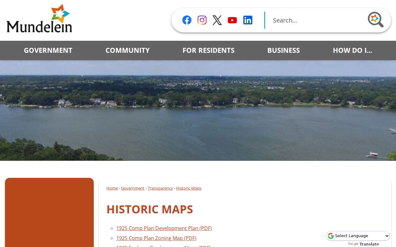
These maps help bridge an old lot or road to the current street grid. No official citywide renumbering year was found, so confirm a suspected change with a plat, street guide, and Village Planning or Engineering instead of assigning a date.
Voter Evidence on Mundelein Streets
Illinois election records can add a registered name, address, precinct, status, and eligible history fields under the rules in 10 ILCS 5. They do not disclose ballot choices. Lake County controls inspection and electronic-data requests, and qualifying restrictions apply to an electronic file. Address Confidentiality Program participants and other protected records are not exposed.
Use a voter entry as one dated point, not as a complete street directory. A person may not be registered, may have moved after the record date, or may be protected. Compare the entry with the assessor's situs field and other lawful sources, but do not turn a block into a guessed household list.
Read Older Mundelein Streets in Reverse
Cook Memorial's digitized 1949 and 1951 regional directories contain street-guide sections that can move from a historic street number to a listed name. The page images require manual transcription and a locality check. A publication is a snapshot, often compiled before its cover date, and should not be treated as proof of present residence.
House numbers became more common locally in the 1920s, while rural and farm properties could lack them. Record abbreviations and punctuation exactly. Then check the alphabetical entry, a deed, census, telephone book, or obituary. For the collections and how their entries work, use the Mundelein city directory collection.
Limits of Mundelein Street Records
A Mundelein street directory built from public records cannot identify every current occupant. Tax and deed records focus on property interests. A taxpayer may be an absent owner, trust, company, lender, or mailing recipient. Renters and other household members are not indexed in one open official roster. Utility customer lists are not public simply because an address is known.
Motor vehicle addresses are restricted by the federal Driver's Privacy Protection Act and 625 ILCS 5/2-123. Voter-file rules also limit access, especially for protected participants. Map labels may be generalized, and neither an assessor card nor a parcel viewer is a legal survey.
Lawful use. Use Mundelein address records for lawful personal research. Never use a street search to stalk, harass, threaten, or harm anyone.
The most reliable result states exactly what each record proves. A deed can identify parties to a transfer. A dated directory can associate a listed name with an address. Neither one, alone, proves who lives there now.